Create Interactive Flash Maps using amMap
amMap is a free customizable and interactive Flash maps for
your websites, presentations, e-learning tools and more. Maps can be
used to show locations of your offices, routes of your journeys, create
your distributor map, or to show complex dated interactive data at
irregular intervals.
 |
With amMap, you can:
- customize every detail of your map – sizes, colors, disable features you don’t need;
- create multi-level structures;
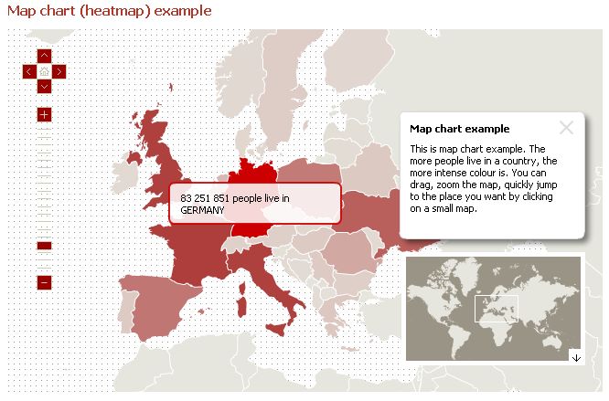
- create map charts (heatmaps);
- load icons or other custom movies or photos on top of your map;
- use your own custom map textures;
- draw lines and add text;
- set the start-up zoom level and position;
- use it as zoomifyer to display big pictures;
- control the map with JavaScript (reload data and settings, set and get data and separate parameters, register clicks);
- export the map as an image.
No comments:
Post a Comment